

In the summer of 2025, partners from the IM⁴CA project’s Work Package 2 – Arctic Emissions conducted their first field campaign in Scandinavia.
The Arctic remains a key region for methane research, as its vast carbon stores in permafrost and wetlands are highly sensitive to climate change. Rising temperatures and thawing soils can significantly enhance methane emissions, making continuous monitoring essential.
A team of micrometeorology and remote sensing scientists from the GFZ Helmholtz Centre for Geosciences, led by Torsten Sachs (including Christian Wille, Mathias Zöllner, and Johannes Wilk), joined forces with researchers from the Finnish Meteorological Institute (Ilmatieteen laitos), including Tuula Aalto, Hannakaisa Lindqvist, Rigel Kivi, Mika Aurela, and many others. Together, they monitored methane fluxes from Arctic wetlands across northern Scandinavia.
As part of the IM⁴CA project, existing observation infrastructure, such as ICOS and other eddy covariance stations, was complemented with advanced drone and balloon-based AirCore measurements, expanding the monitoring capabilities during the campaign.
On 3 July 2025, the GFZ team, led by Torsten Sachs, began their fieldwork at the first measurement site in Sodankylä, Finland (67.3618° N, 26.6382° E). The Sodankylä research supersite hosts an integrated observation system designed to measure methane fluxes and concentrations across multiple ecosystems. Here, especially, the wetland area, including the mesotrophic fen Halssiaapa was a core region for the campaign.
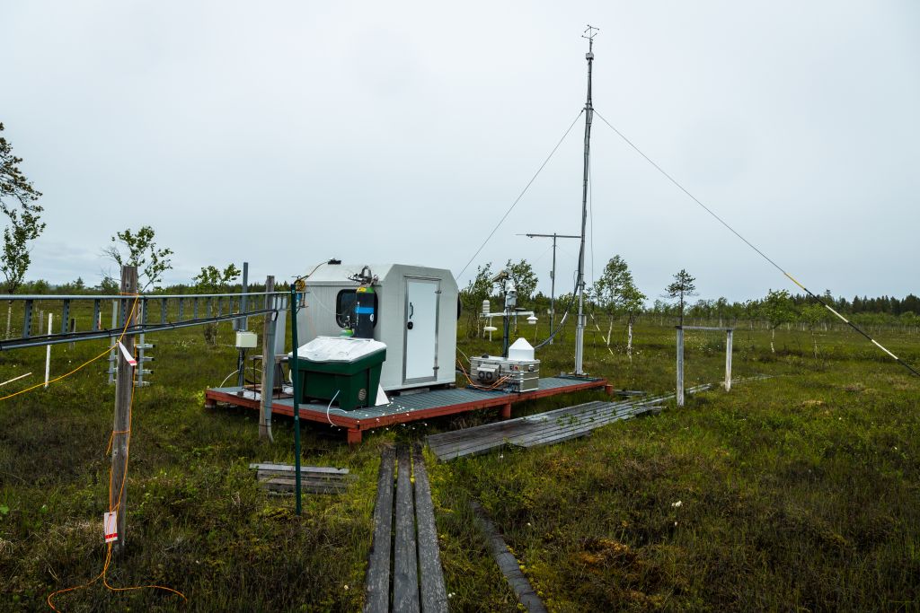
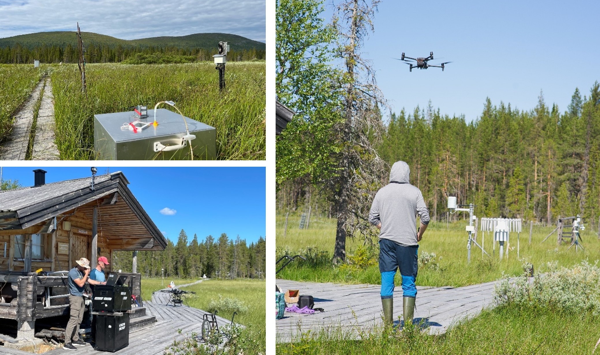
Eddy covariance station at the mesotrophic fen Halssiaapa in Sodankylä. Here, methane fluxes have been recorded for the last 13 years.
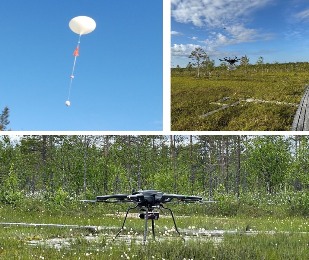
Impression of IM4CA Campaign activities at Sodankylä: (a – top left) AirCore soundings, (b – top right) drone-based AirCore sampling, (c – bottom) and Lidar drone flights at Sodankylä.
During the campaign activities at Sodankylä, the team conducted a wide range of observations, including EM27/SUN measurements, balloon AirCore soundings, and drone-based AirCore sampling. Additional activities included L-band drone imaging, surface soil moisture sampling, 149 chamber flux measurements, hyperspectral and RGB drone imaging, and LiDAR drone surveys.
The second site visited during the campaign was Pallas (67°58′ N, 24°07′ E). Similar to Sodankylä, this Atmosphere–Ecosystem Supersite is extensive and hosts a comprehensive network of continuous measurements monitoring atmospheric methane concentrations and fluxes (https://en.ilmatieteenlaitos.fi/pallas-atmosphere-ecosystem-supersite). One of the core research areas within the site is the Lompolojänkkä peatland, a long-term study area for greenhouse gas exchange and ecosystem processes.
Eddy covariance station Lompolojänkkä near Pallas. At this station methane fluxes have been recorded for the last 11 years.
At Pallas, the FMI and GFZ teams also conducted a diverse set of observations, including L-band drone imaging, drone-based AirCore sampling, surface soil moisture sampling, hyperspectral and RGB drone imaging, LiDAR drone surveys, and 150 methane flux chamber measurements.
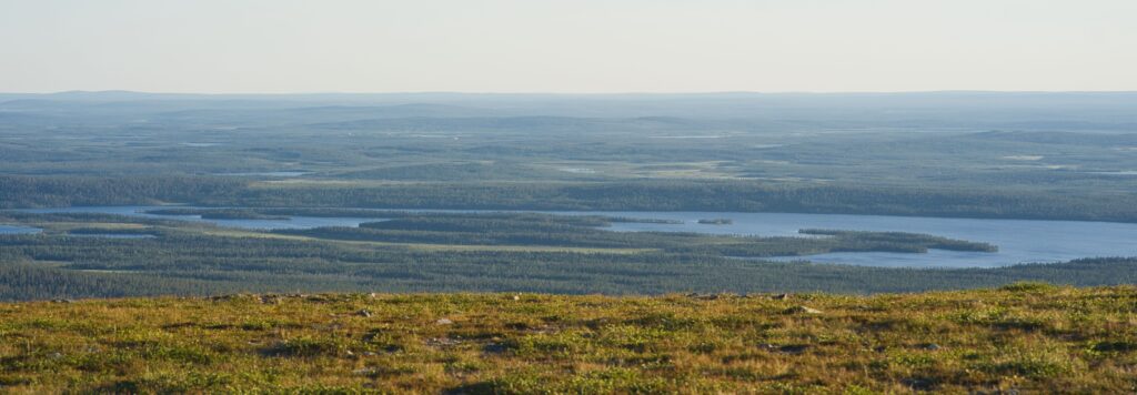
The final site visited during the campaign was Abisko–Stordalen (SE-Sto; 68°21′ N, 19°03′ E; 360 m a.s.l.), a rain-fed peat bog located within the sporadic permafrost zone (10–50%) near Lake Torneträsk (https://www.icos-sweden.se/abisko-stordalen). This long-term research site is part of the ICOS Sweden network and serves as a key location for studying permafrost thaw, methane fluxes, and vegetation dynamics in northern peatlands. Together, Sodankylä, Pallas and Abisko–Stordalen represent a gradient in climatic, hydrological, and ecological conditions that are characteristic of northern Scandinavia.
At Abisko-Stordalen, the GFZ and FMI teams conducted their final field observations of the IM⁴CA 2025 campaign, including L-band drone imaging, drone-based AirCore sampling, surface soil moisture sampling, hyperspectral and RGB drone imaging, and LiDAR drone surveys.
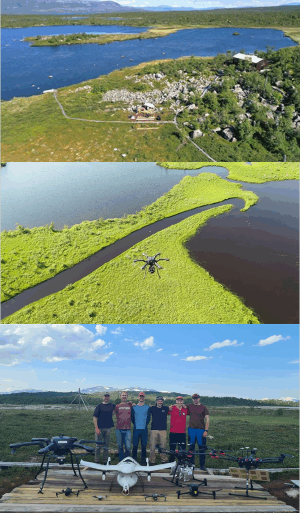
Fron top to bottom: Lake Torneträsk (https://www.icos-sweden.se/abisko-stordalen), an impression of a drone flight over the palsa bog and a photo with the drone campaign team.
Acknowledgements: We sincerely thank Dr. Inge Wiekenkamp for her valuable contribution in drafting this news item. We gratefully acknowledge Johannes Wilk for his contributions, particularly for taking many of the photographs, and we also thank the FMI team for additional images.